Teaching Kids Star Navigation
If the signal drops and the battery dies, does their world end or does their true navigation begin? Our ancestors navigated oceans using only the lights in the sky. This summer, give your kids a sense of direction that doesn’t require a Wi-Fi connection or a charging cable.
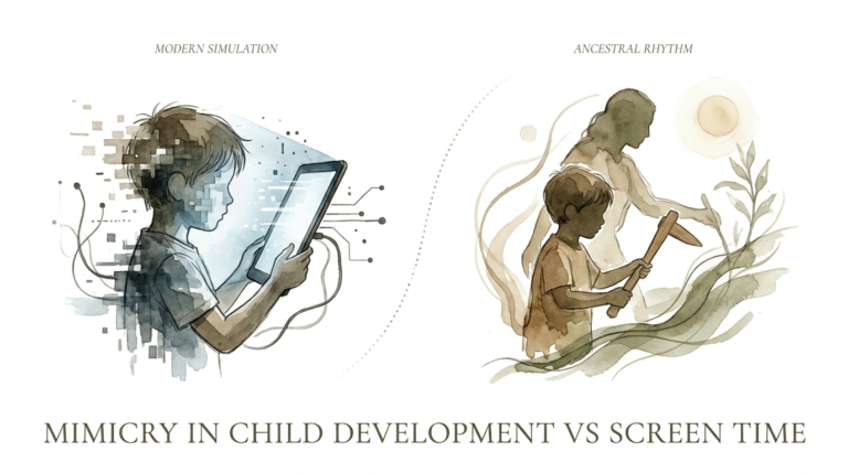
Modern childhood is often tethered to a digital tether. We hand our kids a tablet to find a grocery store two blocks away. But there is a deeper, more ancient skill waiting just above the rooftops. Teaching your children to read the stars is about more than just finding North; it is about building confidence and connecting them to the cosmos.
The night sky is the ultimate open-source map. It never needs an update, and it doesn’t track your data. When a child learns to spot Polaris or trace the path of the Moon, they are participating in a tradition that spans thousands of years. They transition from being passive passengers to active explorers of their environment.
This guide will walk you through the essentials of celestial navigation for the next generation. You don’t need a PhD in astrophysics to get started. All you need is a clear night, a bit of curiosity, and the willingness to look up together. Let’s turn the backyard into a laboratory of discovery.
Teaching Kids Star Navigation
Star navigation is the art of using celestial bodies to determine position and direction. It is a fundamental survival skill that has guided humans across deserts, mountains, and oceans for millennia. For a child, it is like learning a secret code that only the sky can reveal.
The core concept is simple: because the Earth rotates on a fixed axis, certain stars appear to remain stationary while others move in predictable patterns. By identifying these “anchor” stars, we can establish the cardinal directions of North, South, East, and West. It provides a reliable frame of reference that works anywhere on the planet.
In the real world, this skill is still used by mariners, aviators, and elite military units as a fail-safe backup to electronic systems. It exists because technology is fragile, but the stars are constant. Teaching this to kids introduces them to geometry, history, and spatial reasoning in a way that feels like a game.
Imagine your child standing in a dark field, identifying the Big Dipper and using it to find the North Star. In that moment, they aren’t just looking at dots of light. They are visualizing the Earth’s tilt and their own place on its surface. It turns an abstract scientific concept into a physical, felt experience.
How It Works: Finding Your Way with the Stars
The secret to teaching kids is to start with the “Big Three” markers: the North Star for the Northern Hemisphere, the Southern Cross for the Southern Hemisphere, and Orion for East and West. These are the bright, unmistakable signs that provide immediate results.
Finding North with Polaris
In the Northern Hemisphere, everything revolves around Polaris, the North Star. It is uniquely positioned almost directly above the Earth’s North Pole. This means that while other stars “spin” through the night, Polaris stays put. If you are facing Polaris, you are facing True North.
To find it, first locate the Big Dipper (Ursa Major). Look at the two stars that form the outer edge of the “cup” opposite the handle. These are called Merak and Dubhe, the Pointer Stars. Draw an imaginary line through them and extend it out about five times the distance between them. The first bright star you hit is Polaris.
Finding South with the Southern Cross
For those in the Southern Hemisphere, the Southern Cross (Crux) is the primary guide. Since there is no “South Star” directly over the pole, we use a technique called “star pointing.” Look for the four stars that form a distinct cross shape in the sky.
Follow the long axis of the cross downward. Then, find the two bright “Pointer Stars” nearby (Alpha and Beta Centauri) and draw a line between them. Find the middle of that line and drop a perpendicular line down. Where that line intersects with the line from the cross is where True South lies on the horizon.
Finding East and West with Orion
Orion the Hunter is a celestial powerhouse because he is visible from almost everywhere on Earth. His belt consists of three stars in a nearly perfect straight line. The rightmost star in the belt (Mintaka) rises almost exactly in the East and sets almost exactly in the West.
If Orion is rising, his belt points the way to the sunrise. If he is setting, he marks the way home to the sunset. This makes him an incredible tool for cross-hemisphere travel and for kids to understand the general rotation of the Earth from West to East.
Measuring the Sky with Your Hands
You don’t need a sextant to measure distances in the sky. Your hands are built-in tools for measuring degrees of altitude. This is one of the most exciting parts for kids because it makes the sky feel tangible and measurable.
- The Pinky Finger: Held at arm’s length, your pinky covers about 1 degree of the sky. This is roughly twice the width of the full Moon.
- The Three Middle Fingers: These cover about 5 degrees. This is useful for measuring the distance between “pointer stars.”
- The Closed Fist: A fist at arm’s length covers about 10 degrees. If you stack your fists from the horizon up to the North Star, you can estimate your latitude.
- The “Hang Loose” (Shaka): Extending your thumb and pinky covers about 25 degrees. This is the approximate “length” of the Big Dipper.
Teach your kids to “walk” their fists up from the horizon. If they count four fists to reach the North Star, they are at roughly 40 degrees latitude. This works because the altitude of Polaris is equal to your latitude on Earth. It is a piece of “sky math” that never fails to impress.
Benefits of Celestial Navigation for Children
The advantages of this skill go far beyond mere survival. It changes the way a child’s brain processes information. In an era of instant gratification, star navigation requires patience, observation, and critical thinking.
Spatial Reasoning: Kids learn to visualize 3D space and understand how objects move relative to one another. This is a foundational skill for mathematics and engineering. When they map the sky, they are mapping their own cognitive abilities.
Screen-Free Bonding: There is something magical about standing in the dark with your child, whispering about constellations. It removes the distractions of modern life and forces a shared focus on the natural world. It creates memories that are far more durable than anything found on a smartphone.
Self-Reliance and Confidence: Knowing you can find your way home without a map is a massive boost to a child’s self-esteem. It fosters a sense of “agency”—the belief that they can solve problems using their own minds and senses rather than relying on an external device.
Historical Connection: Learning to navigate connects kids to the Great Age of Discovery. They aren’t just doing a science project; they are using the same tools as the Polynesians who crossed the Pacific or the sailors who first mapped the Atlantic. It makes history come alive through action.
Challenges and Common Mistakes
The most common hurdle is light pollution. In a bright city, many of the dimmer stars in constellations like the Little Dipper disappear. This can be frustrating for a beginner. Always start by finding the brightest stars first, and move to a darker location if possible.
Impatience: Kids often expect the sky to look exactly like the drawings in books. In reality, the sky is vast and can be overwhelming. To avoid this, focus on identifying just one constellation per night. Success with one “anchor” is better than confusion with ten.
The “Rotating Sky” Confusion: Children often forget that the stars move throughout the night. They might find a star in the East at 8:00 PM and expect it to be there at midnight. Explain the “Carousel Effect”—the Earth is the spinning platform, and the stars are the stationary lights outside the tent.
Mistaking Planets for Stars: Kids will often point to a bright light and call it a star, only to find it doesn’t fit the map. Planets don’t “twinkle” as much as stars because they are closer. Teach them the rule: “Stars twinkle, planets glow.” Venus and Jupiter are frequent “imposters” in the navigation game.
Limitations of Star Navigation
While powerful, star navigation has realistic constraints that every practitioner must understand. These limitations help kids learn that every tool has its proper time and place. It strengthens their overall “navigational literacy.”
The Weather Barrier: Cloud cover is the ultimate enemy of the star map. If you can’t see the sky, you can’t use the stars. This is why natural navigators also learn to read moss on trees, wind patterns, and the behavior of animals. No single system should be used in isolation.
The Horizon Problem: If you are in a deep valley or a dense forest with a high canopy, you may not have a clear view of the horizon or the circumpolar stars. Understanding “sky windows”—the patches of sky you can see—becomes a necessary advanced skill in these environments.
Precision vs. General Direction: Without advanced tools like a sextant or a chronometer, navigating by eye only gives you a general heading. It can tell you which way is North, but it won’t give you your exact street address. It is a “macro” tool for big-picture direction finding.
Hemisphere Isolation: Some stars are only visible in one half of the world. A child who learns only the Big Dipper will be lost in Australia. This is why teaching the concept of the Celestial Equator and stars like Orion is so important for a global understanding.
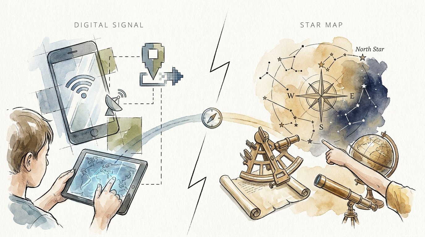
Digital Signal vs. Star Map
It is helpful to compare these two systems to show why both are valuable. One is about high-speed convenience, while the other is about high-reliability understanding. Use this table to talk through the differences with your kids.
| Feature | Digital Signal (GPS) | Star Map (Celestial) |
|---|---|---|
| Power Source | Battery / Charging Cable | None (Gravity & Nuclear Fusion) |
| Reliability | Fails if signal is blocked | Fails if clouds are present |
| Learning Curve | Low (Follow the blue dot) | High (Requires observation) |
| Perspective | Small-scale (The street) | Universal (The planet) |
| Maintenance | Software updates required | None (Constant for 10,000 years) |
Notice that the Star Map doesn’t replace the GPS; it provides a different kind of “signal.” One tells you where to turn; the other tells you where you are in the universe. Encouraging kids to use both makes them versatile, well-rounded thinkers.
Practical Tips and Best Practices
To make the experience successful, you need to set the stage for discovery. Navigation is easier when the observer is comfortable and prepared. Here are some immediate ways to improve your stargazing sessions.
- Use a Red Flashlight: White light “bleaches” the chemicals in the eye that allow us to see in the dark. A red light (or a piece of red balloon over a standard light) preserves night vision. This allows kids to look at their star maps and then back at the sky without waiting for their eyes to readjust.
- Wait 20 Minutes: Human eyes take about twenty minutes to fully adapt to the dark. Spend this time telling stories or talking about the history of explorers. Once the eyes “click” into night mode, the sky will suddenly seem five times more crowded with stars.
- Practice “Star Hopping”: Don’t look for random dots. Start at a bright, familiar constellation (the “home base”) and “hop” to the next one using pointer stars. It’s like following a trail of breadcrumbs in the sky.
- Keep a Sky Journal: Have your child draw what they see. They don’t need to be artists. Simple dots and lines are fine. Comparing a drawing from June to a drawing from December will teach them about the changing seasons more effectively than any textbook.
Start your practice in the backyard where it is safe and familiar. Once they can find North from their own porch, take them to a park or a campsite. The change in environment will challenge their skills and make the success feel even more rewarding.
Advanced Considerations for Young Navigators
Once the basics are mastered, you can introduce more complex concepts that bridge the gap between “looking” and “calculating.” This is where the real fun begins for older kids or serious practitioners.
The Moon Stick Method: You can find East and West using the Moon and two sticks. Drive a long stick into the ground and mark where the Moon’s shadow falls with a smaller stick. Wait 15 minutes and mark the new position. The line between the two markers runs East-West. It works exactly like a sundial but at night.
Building a Homemade Quadrant: You can build a tool to measure latitude using a protractor, a piece of string, and a heavy nut or washer. By sighting Polaris through a straw taped to the protractor, the string will hang down and indicate your latitude in degrees. This is a classic STEM project that provides high-accuracy results.
Sidereal vs. Solar Time: Challenge your kids to observe the same star at the exact same time every night for a week. They will notice it is in a slightly different spot. Explain that stars rise four minutes earlier each day. This is the difference between how we measure time (the Sun) and how the universe moves (the Stars).
Examples and Scenarios
To see how this works in practice, let’s look at a realistic scenario. Imagine you are on a family camping trip. After a long hike, you realize your phone has no signal and the sun is beginning to set. You need to know which way to walk to get back to the trailhead, which you know is to the South.
Your child looks up as the first stars appear. They spot the “saucepan” shape of the Big Dipper. They locate the pointer stars, Merak and Dubhe, and trace the line to Polaris. “That way is North,” they say, pointing behind them. “So we need to walk exactly opposite of that star to find the trailhead.”
In this moment, the theory becomes reality. The child isn’t guessing; they are using data provided by the universe. Even though you are never truly in danger, the validation of that skill is a powerful milestone. They have successfully used a system that is billions of miles away to solve a problem right under their feet.
Another example is the “Backyard Treasure Hunt.” Hide a small prize in the yard. Give your child a set of “celestial clues” like: “Face the North Star, turn 90 degrees to your right (East), and walk ten paces.” It turns navigation into a physical puzzle that reinforces directional awareness.
Final Thoughts
Teaching kids star navigation is one of the greatest gifts you can give them. It is a skill that costs nothing, requires no hardware, and lasts a lifetime. By looking up, they learn to look within—developing the focus, patience, and logic necessary to navigate the complexities of the modern world.
The sky is a 24/7 navigation suite that has been waiting for them to log in. This summer, take the time to step away from the glowing rectangles of our devices and embrace the glowing spheres of the cosmos. Whether they are in the backyard or the deep wilderness, they will never truly be lost as long as they can read the lights in the sky.
Encourage them to experiment, to make mistakes, and to keep asking questions. The stars have much to tell us, but we have to be quiet enough to listen and observant enough to see. Start tonight. The map is already open.
Sources
1 youtube.com | 2 imthecheftoo.com | 3 reginasailing.com | 4 teachengineering.org | 5 kiddle.co | 6 youtube.com | 7 naturalnavigator.com | 8 elephango.com | 9 amnh.org | 10 telescope-simulator.com | 11 schoolsobservatory.org | 12 kubrio.com | 13 itstactical.com | 14 nationalgeographic.com | 15 mountainhouse.com | 16 instructables.com | 17 scouts.org.uk | 18 nasa.gov | 19 science-sparks.com | 20 oharamill.ca | 21 wikihow.com