Cloud Identification Printables For Kids
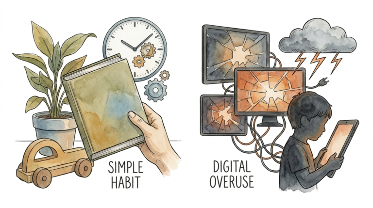
The weather app tells you it’s raining; the precision log tells you *why* the rain is coming before it even starts. We have outsourced our intuition to algorithms. When we want to know the weather, we look at a screen instead of the sky. Our Precision Sky Observation printables teach children to read the atmosphere itself. Logging cloud formations and pressure shifts helps them learn to predict the weather with 90% accuracy—no Wi-Fi required. It’s time to trade the icon for the observation.

Cloud Identification Printables For Kids
Cloud identification printables for kids serve as a physical bridge between abstract science and the real world. These tools are designed to help young observers categorize the massive, shifting structures of water vapor floating above our heads. Instead of just seeing “white fluffy things,” children use these guides to identify specific formations like Cirrus, Cumulus, or Stratus. Each name carries a meaning and a message about what the atmosphere is doing in that exact moment.
Real-world meteorology relies on these same classifications. Pilots, sailors, and farmers have used cloud shapes for centuries to make life-or-death decisions. When a child uses a printable cloud viewer—a simple frame that highlights specific cloud types—they are practicing the same foundational skills used by professional storm chasers. These printables exist to turn a passive walk in the park into an active data-collection mission. They provide the vocabulary and the visual cues needed to translate the language of the sky into a local forecast.
Visualizing the concept is easy if you think of the sky as a giant, ever-changing book. The clouds are the words, and the weather is the story. Without a guide, the story looks like gibberish. With cloud identification printables, the “letters” start to make sense. High, wispy clouds suggest fair weather but a coming change, while low, heavy blankets mean a drizzle is imminent. These tools provide the “decoder ring” for the natural world.
Precision Sky Observation: How to Predict the Weather
Predicting the weather with precision starts with looking up and looking often. The process is a combination of identifying the “who” (the cloud type) and the “where” (the altitude). Meteorologists split the sky into three main levels: high, middle, and low. Most Precision Sky Observation printables will organize clouds based on these elevations because altitude tells you a lot about the temperature and stability of the air.

Follow these steps to turn a simple sky-gazing session into a scientific observation. First, find a clear view of the horizon away from tall buildings. Use your identification printable to find a match for the most dominant cloud in the sky. Note the shape and texture. Are they thin and wispy? Those are high-level clouds, likely made of ice crystals. Are they puffy and tall? Those are vertical growth clouds that could signal a coming storm.
Next, estimate the cloud cover. Divide the sky into four or eight sections in your mind. Record how many of those sections are filled with clouds. A sky that is more than half full often indicates a change in air pressure. Tracking the direction of movement is also vital. Use a compass or a familiar landmark to see where the clouds are heading. If high clouds are moving in a different direction than the wind at the surface, a weather front is likely approaching.
Finally, log the color of the sky. A deep blue sky suggests dry air and stable weather. A pale, hazy, or white sky often means moisture is moving into the upper atmosphere, which frequently precedes rain. Consistent logging allows kids to see patterns. When they see a specific cloud followed by rain three days in a row, the connection becomes permanent in their minds.
The Benefits of Logging the Sky
Precision logging offers measurable advantages that extend far beyond simply knowing when to carry an umbrella. The most immediate benefit is the development of sharp observation skills. Children learn to notice minute details, such as the darkening of a cloud’s base or the speed at which a “mackerel sky” forms. These habits of attention are fundamental to all scientific disciplines, from biology to engineering.
STEM motivation increases when learning feels like a superpower. Predicting a thunderstorm three hours before the local news mentions it gives a child a sense of agency and expertise. This approach encourages a deep connection to the natural world. Instead of seeing the environment as a backdrop for a screen, children see the atmosphere as a living, breathing system. This connection often fosters better environmental stewardship and a lifelong interest in earth sciences.
Mental health benefits are also significant. Cloud watching is a form of active mindfulness. It requires a child to slow down, breathe, and focus on something outside of themselves. Experts often recommend nature observation to reduce stress and “turn off” the fight-or-flight response. The combination of quiet observation and the intellectual challenge of identification creates a balanced, high-value educational experience.
Common Mistakes in Weather Observation
Beginners often make the mistake of looking at the sky only once. Weather is a movie, not a still photograph. A single snapshot of a cloud doesn’t tell you the whole story. You must observe how the clouds change over thirty minutes or an hour. Is that Cumulus cloud getting taller or flatter? Flattening clouds mean the atmosphere is stabilizing, while growing clouds mean energy is building.
Another frequent pitfall is ignoring the “big picture” of the sky. Kids sometimes focus on one interesting cloud and ignore the gray layer moving in from the west. Precision observation requires looking at the entire dome of the sky. Professionals look for “precursor” signs, like high-altitude Cirrus clouds that appear 24 to 48 hours before a storm. Missing these early signs can make the final weather change seem more sudden than it actually was.
Over-reliance on one single tool is a common error. A cloud chart is powerful, but it works best when paired with other data. For example, ignoring the wind direction or the “feel” of the humidity can lead to inaccurate predictions. Beginners often forget that local geography, like hills or large lakes, can change how clouds behave in their specific area. Teaching kids to account for their local environment is the key to moving from 70% to 90% accuracy.
Limitations of Visual Sky Observation
Visual observation has realistic constraints that every practitioner must understand. Nighttime is the most obvious limitation. While you can see some cloud movement against the moon or stars, detailed identification becomes nearly impossible in total darkness. This gap in data is why modern meteorologists rely on infrared satellite imagery to track systems overnight.
Complex weather fronts can also make visual reading difficult. Sometimes multiple layers of clouds overlap, creating a “cloud soup” that hides the most important signals. If a low-level Stratus deck is completely covering the sky, you might not see the high-level indicators of a major storm system moving in above it. In these cases, the “visible” sky only tells part of the story.
Micro-climates pose another challenge. A cloud identification printable might say a specific formation leads to rain, but a local mountain range could “squeeze” the moisture out of the clouds before they reach your backyard. These environmental boundaries mean that visual observation is highly localized. It is an incredible tool for short-term, local forecasting, but it cannot replace global satellite data for predicting long-term climate trends.
Manual Observation vs. Digital Apps
| Factor | Standard Weather App | Precision Sky Observation |
|---|---|---|
| Source of Data | Remote sensors and algorithms | Direct local observation |
| Skill Level | Passive reading | Active analysis and deduction |
| Reliability | High for general regions | High for immediate local area |
| Connectivity | Requires Wi-Fi/Cellular | Completely offline |
| Educational Value | Minimal | High (STEM, Logic, Nature) |
Comparing these two methods shows a clear divide between convenience and understanding. Digital apps provide a quick answer, but they don’t explain the logic behind the forecast. Precision Sky Observation forces the user to engage with the physics of the atmosphere. While an app might be more efficient for planning a week-long trip, the manual log is superior for building real-world intuition and survival skills.
Best Practices for Young Meteorologists
Creating a consistent routine is the best way to improve accuracy. Set a “Sky Check” schedule for three specific times: morning, noon, and evening. Recording data at these intervals allows the observer to see the daily cycle of the atmosphere. Morning observations are particularly important because they often set the stage for afternoon developments. For example, seeing Altocumulus clouds (small gray puffs) in the morning is a classic sign of afternoon thunderstorms.
Using the right physical tools makes the process much more engaging. A cardboard “Cloud Viewer” frame helps children isolate specific cloud types against the blue sky. This reduces the overwhelming nature of a busy sky. Pair the printable with a DIY barometer—a simple jar with a balloon stretched over the top and a straw taped to it. When the straw moves up or down, it shows changes in air pressure that confirm what the clouds are saying.
Keep the logging process simple but descriptive. Instead of just writing “Cloudy,” encourage the use of descriptive adjectives. “Thin, wispy threads” or “heavy, dark blankets” help build a mental library of atmospheric states. Always include a section in the log for “What happened next?” This feedback loop is essential. If a child predicts rain and it stays sunny, they can go back and analyze what they missed.
Advanced Atmospheric Considerations
Serious practitioners eventually look beyond just the shapes of clouds. Understanding pressure gradients and humidity levels adds a layer of depth to every observation. High pressure generally means the air is sinking, which prevents clouds from forming and results in clear skies. Low pressure means air is rising, cooling, and condensing into clouds and precipitation.
Watching the “vertical development” of a cloud is a skill for advanced beginners. If you see a Cumulus cloud that looks like a cauliflower head, it is growing vertically. If the top of that cloud starts to flatten out into an “anvil” shape, you are looking at a Cumulonimbus cloud. This anvil indicates that the cloud has reached the top of the troposphere and is now a mature, dangerous storm.
Humidity also leaves clues in the sky. Contrails—the white streaks left by airplanes—are excellent indicators of upper-atmosphere moisture. If a contrail disappears quickly, the air is dry. If it lingers and spreads out, the atmosphere is full of moisture and a storm front is likely approaching. Teaching kids to “read” these man-made clouds provides even more data points for their precision log.
A Practical Scenario: Predicting the Rain
Imagine it is a Tuesday morning and the sky is a deep, clear blue. A young observer notices thin, wispy Cirrus clouds shaped like “mares’ tails” high in the sky. Using their printable, they identify these as high-level ice clouds. They log the observation and note that the wind is blowing from the south. The weather app says it will be sunny all day.
By Tuesday afternoon, the sky has turned a pale, milky white. This is Cirrostratus, a sign that moisture is thickening. The observer notices a “halo” around the sun, which is caused by light refracting through ice crystals. This is a classic indicator that rain is usually 12 to 24 hours away. They update their log: “Pressure dropping, sky thickening.”
Wednesday morning arrives with a low, gray blanket of clouds that covers everything like a dark sheet. These are Stratus clouds. The air feels heavy and damp. Based on the progression from Cirrus to Cirrostratus to Stratus, the observer predicts rain will start before lunchtime. At 10:30 AM, the first drops fall. The child didn’t need a notification on their phone because they saw the “story” of the storm being written in the sky for nearly 24 hours.
Final Thoughts
Mastering the art of sky observation is about more than just predicting the rain. It is about reclaiming a lost human skill and teaching the next generation to trust their eyes over their screens. These cloud identification printables provide the structure needed to turn curiosity into competence. Every page of a weather log represents a moment of focus, a bit of data, and a deeper understanding of the world.
Start small by spending five minutes a day looking up. Use the printables to identify one cloud type at a time. Over time, the patterns will become obvious, and the sky will stop being a mystery. You are not just learning about the weather; you are learning how to see. This journey into Precision Sky Observation is a path toward a more observant, connected, and scientifically literate life. Keep looking up, keep logging, and let the atmosphere tell you its story.
Sources
1 nationalgeographic.com | 2 childhoodbynature.com | 3 centrepointschools.com | 4 thehomeschoolscientist.com | 5 kiwico.com | 6 thezoofamily.com | 7 ducksters.com | 8 instructables.com | 9 sciencelearn.org.nz | 10 montessorinature.com | 11 weather.gov | 12 scienceexplorers.com | 13 schooliseasy.com | 14 littlebinsforlittlehands.com | 15 hypergogo.com